
No products in the cart.
Sale!


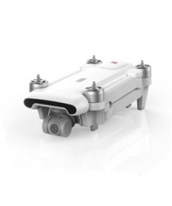
Drone SG906 MAX PRO/PRO2 Beast 3 GPS 3-Axis Gimbal 4K FPV 5G WIFI Dual Camera Professional 50X Zoom Brushless Quadcopter VS F11
$189.00 – $315.00
![]()
Related products


Note:There are SG906 Max SG906 pro and SG906 pro2 in the link, please pay attention when buying
The parameter comparison of SG906pro and SG906 pro2 are shown in the figure below, please compare carefully. In addition, Pro and Pro2 are of the same series, so both packaging boxes are written SG906 pro2. Thanks

2020 SG906 MAX PRO2/ SG906 PRO Drone GPS 3-Axis Gimbal 4K 5G WIFI Dual Camera Professional 50X Zoom Brushless Quadcopter RC Drone
SG906MAX:
Description:
Product Name:SG906 MAX Drone
Brushless Motor:1806
Three-Axial Stabilized mechanical Pan-Tilt
Support TF Card: Up to 32GB
Smartphone WIFI Receiving method:5G WIFI
Remote Receiving method:2.4Ghz
Flight endurance:23-27 min
Charging time:360 min
Remote control distance:1200m
Drone battery:7.6V 3400mAh
Remote control battery:3.7V 500mah
fuselage dimension:28.3×25.3x7cm(opened)17.4×8.4x7cm(folded)
Rotation angle of Elc. Rotatable camera:110°
angle of Aerial photography:120°
distance of image return:600-800M
Flying height:About 0-120M
distance of GPS:30M
distance of image follow:3-10M
Recognizable distance of gesture photo:1-3M
Transmission Frames rate:25 fps
Photo resolution:4096*3072(TF)4096*3072(APP)
Video resolution:2048*1080(TF)1208*720 (APP) HD mode:2048*1080(APP)
Package: Collect Bag
Drone weight: About 585.6g(include Obstacle avoidance)
SG906 Max:
1. GPS returns to the take-off point with one key, low power return, no signal.
2. ① GPS smart follow: After the aircraft is connected to the GPS, open the APP follow function, and the aircraft will follow the mobile phone.
②Image follow: 1-5m from the aircraft to identify the subject and automatically follow the flight.
3. Gesture shooting recognition: within 1-5m from the aircraft, face the camera to make a photo gesture/camera gesture.
4. Multi-point flight planning for the route: The aircraft will fly autonomously according to the preset route, and the player will focus on shooting.
5. Fixed-point surround: find the center point of the surround, and then use the joystick to move the desired surround radius.
6. Aircraft retrieval function: Click the GPS signal icon 3 times to open the map interface, the map displays the last distance, latitude and longitude of the aircraft.
Obstacle avoidance function:
The obstacle avoidance device detects whether there are obstacles ahead through the 120° fan-shaped scanning in front of the laser, and the remote control will sound an alarm if the obstacle is detected within 20 meters, and the drone cannot move forward


| Brand Name | FIJ |
|---|---|
| Camera Features | 720p HD Video Recording |
| Origin | CN(Origin) |
| Camera Integration | Camera Included |
| Certification | CE |
| Sensor Size | None |
| Remote Distance | 1200m |
| Gyro | Build in 6 Axis Gyro |
| Aerial Photography | Yes |
| Optical Zoom | 50x |
| FPV Operration | Yes |
| Main Rotor Diameter | 12.4cm |
| Control Channels | 4 Channels |
| Frequency | 2.4Ghz/5Ghz |
| Model Number | SG906 MAX PRO/PRO2 |
| Connectivity | Wi-Fi Connection |
| Pixels | 12 million |
| Flight Time | 25min |
| Camera lens | Adjustable camera by transmitter, 110° |
| Front Camera | 4096*3072P Photo Camera |
| Camera 1 | 1280*720p Video Camera |
| Camera 2 | 3-Axis mechanical self-stabilizing head |
| Focal length | 50X |
| GPS/GLONASS double mode | Yes |
| GPS Follow me | 30M |
| Drone Battery | 7.6V 3400mah |
| Tap flight | Yes |
| Fixed point surround | Yes |
| Charging time | About 6 hours |
| Age Range | >14 years old |
| Type | Quadrocopter |

